Showing posts with label Gooseberry Mesa. Show all posts

Monday, May 6, 2019

Slickrock, a Van, and a Poodle


More times than not, Terry’s spring break is synonymous with road trip, and this year we decided on southern Utah—again. Both of us are hooked on this slickrock wonderland. Which is why we have ventured into these parts frequently over the years. This time we would be taking the camper van, which hadn’t seen a road trip in almost two years—in fact, the engine hadn’t been cranked over in five months! Would it even start? I pulled the car cover off and put the key in the ignition... It fired right up.

Okay, the van runs. But what about me? I’ve been on the bench much of the past seven months, in addition to a creaky knee that has slowly been getting worse over the past year, further bloating my curmudgeon demeanor. But Terry was having none of it. She knew that the best medicine was to lose myself under a big desert sky. 

“Suck it up,” she razzed me lightheartedly. “And we’re bringing the mountain bikes.”

Mountain Bikes. I have a love-hate relationship with those two-wheeled demons. They’re thrilling to ride, but more precarious than a drunken late-night shootout in a Tombstone saloon. “Easy trails only,” I insisted. Which was amenable because neither of us were in peak shape. Mellow hikes and bike rides with the dog were on the agenda, and Grand Staircase-Escalante National Monument was to be our prime objective. I organized the trip; packed and loaded up the van while Toby supervised—which was his way to assure I didn’t forget his favorite treats and tug toy. When it comes down to it, he seems to enjoy road trips more than we do. 


/\/\/\/\/\/\/\/\/\/\/\/\/\


GOOSEBERRY MESA
This was our first stop, just across the Utah border. It’s the premier mountain-biking destination of the region, overlooking the town of Hurricane with sweeping vistas in every direction. Six bumpy miles of dirt road get you to the top of the mesa, where we camped in a stand of pinyon pine. The single-track trails are well-developed, from cruiser routes to solid black diamonds.

Toby follows Terry on Practice Loop, a good trail for getting the hang of how things roll on the Mesa. It was only Toby's second time riding with us, and he did an exemplary job of keeping up. It seems he can do this all day.


Practice Loop


Camp Gooseberry


The nice view near our campsite.


Ready for more in the morning!


The obligatory pic of my trusty Fuel FX.


Riding Windmill, a scenic intermediate-level trail that undulates along the north rim of Gooseberry Mesa.


A spectacular view of Zion National Park from Windmill trailhead.


Toby got a 'B' on his first official mountain bike outing. But to bring that up to an 'A', he’ll need to stop chasing other riders who are going faster than us.

/\/\/\/\/\/\/\/\/\/\/\/\/\


STATE ROUTE 12
Utah’s Route 12—designated a National Scenic Byway—wanders through some of the most beautiful and remote slickrock country in the state. Driving west to east, it starts at US-89 near Panquitch and ends at Capitol Reef National Park. Between those two points are Red Canyon State Park; Bryce Canyon National Park; Grand Staircase-Escalante National Monument. You’ll pass through the tiny hamlets of Tropic; Cannonville; Henrieville; Escalante; Boulder. There are no stoplights. But there’s plenty of breathtaking scenery.

Our destination was the town of Boulder, population 225. Founded by Mormon settlers in the late 19th century, today it’s a tranquil community of small farms and ranches with some tourist lodging sprinkled into the mix. We stayed two nights at the Boulder Mountain Lodge, which came highly recommended by our good friends, Kevin and Denise. There’s also an award-winning restaurant on the premises, the Hell’s Backbone Grill, to which Kev & Dee raved about as well. We ended up having dinner there both nights. It was that good. Other than those two cushy nights in Boulder, we were “roughing it” in the camper van.

A view of Grand Staircase-Escalante Nat’l Monument from Route 12. The Henry Mountains are forty miles away on the horizon, Mt. Ellen (11,522 ft) on the left and Mt. Pennell (11,371 ft) on the right. 


Blossoming fruit trees on Boulder Mountain Lodge property.

/\/\/\/\/\/\/\/\/\/\/\/\/\


CALF CREEK CANYON
The hike up-canyon to Lower Calf Creek Falls is one of the more popular jaunts in Grand Staircase-Escalante. It’s fairly easy (6 miles round trip). It’s scenic. And on a sunny spring day, the small parking lot at the trailhead will be full by noon. Ranchers discovered the secluded canyon in the 1920s and utilized it for holding cattle, which is how Calf Creek got its name. But long before that, it was home to the ancient Fremont people. They abandoned the site 800 years ago, but if you look closely along the base of the canyon walls, their pictographs and remnants of stone granaries are still visible. Our afternoon hike in was warm. The waterfall was refreshing. And then, while lounging at the pool under the falls, in the middle of the Utah hinterlands 580 miles from home, we bumped into one of Terry’s work colleagues. What are the odds of that?

Calf Creek Canyon, about halfway up to the Lower Falls.


The canyon walls close in as you near the falls.


Der Pudelhund has a knack to finding shade along the trail.


Lower Calf Creek Falls


The falls is 130 feet high. The water was rather chilly.


We ran into Grace, one of the teachers at Terry’s school. Small world!

/\/\/\/\/\/\/\/\/\/\/\/\/\


PEEK-A-BOO & SPOOKY SLOT CANYONS
“You takin’ that dog into the slots?” the man asked incredulously as we scrambled down the slickrock slabs into Dry Gulch.

“He’s not a dog,” I corrected him. “He’s a poodle. But yes, we were planning on it.”

The man and his lady companion, who were hiking out of the gulch, warned us about the tight conditions in the Peek-a-boo and Spooky slot canyons, and that a dog wouldn’t make it. There was rock climbing involved; he’d probably get stuck; we wouldn’t be able to pry him out, etc, etc.

“I wouldn’t take him if he were my dog,” he advised.

“He’s a poodle,” I corrected him again. And then we continued down the slabs.

That was the second time we had been cautioned about taking Toby with us: the first had been in the parking area as we were preparing to start out. But we had just driven twenty-eight miles down a bumpy, wash-boarded dirt road to get to the trailhead, so there was no turning back now. We would just have to play it by ear.

Heading down the trail to Dry Gulch. We didn’t start hiking until mid-afternoon when most people there were heading back up to the cars. This was intentional. I was hoping less people down in the canyons would equate to more solitude. And it did.


Entrance to Peek-a-boo slot. The first obstacle, right out of the wash, is a 15-foot high headwall that involves 3rd-class climbing. 


“It goes, guys!” Toby sprang up the first eight feet, no problem. But we were reluctant to press him to climb further. What if it got more difficult higher up? Maybe those warnings had been for good reason? Playing it safe, I stayed behind with Toby while Ter climbed up and went solo through Peek-a-boo.


The view looking out of Peek-a-boo after ascending the 15-foot headwall.  


Solo canyoneer.


Nature’s artwork in Peek-a-boo. When Terry returned, she reported that the initial headwall was the crux; Toby could have done the entire quarter-mile long slot, easily. I climbed up and ventured in part way to check it out. But it was time to move on. We had another slot to explore.


Entrance to Spooky Gulch slot. 


Are we having fun yet?


Getting narrower. 


Deep in Spooky, where it’s a tight squeeze—except for poodles.  

/\/\/\/\/\/\/\/\/\/\/\/\/\


ENCAMPMENT AT DEVIL'S GARDEN
After exploring the Peek-a-boo and Spooky slot canyons we returned to the van and drove in search of a place to camp. We found a secluded spot near Devil’s Garden, about ten miles back up the dusty Hole-in-the-Rock road. The sun was setting as we cooked dinner. The stars came out and a full moon peeked above the horizon. There was not a sound to be heard but an occasional owl. In the morning, a cow paid us a visit (open range grazing here), striding through camp with not a care in the world and not the least ruffled by a barking poodle. Terry made coffee. Another day begins on the Grand Staircase.

Tranquility under a big desert sky.


After breaking camp the next morning, we explored the rock formations around Devil’s Garden, where we had the whole place to ourselves.


Rin Tin Toby

/\/\/\/\/\/\/\/\/\/\/\/\/\


HOMEWARD BOUND
Alas, it was time to start back home. For the return trip, we drove west over the Markagunt Plateau via SR-14, where the snow and alpine forests certainly contrasted with the desert slickrock of the past week. Down in Cedar City we gassed up. Then we jumped on the southbound I-15, chalking up another outstanding spring break in Southern Utah.

Driving through Red Canyon State Park, home of the Thunder Mountain Trail, one of the best mountain bike rides in the universe.


The view from Cedar Canyon Pass (9,917 ft) on the Markagunt Plateau. It may be spring down in the slickrock canyons, but it’s still winter up in the high country.  


Wednesday, May 25, 2016

Rendezvous in Utah


It all began with a flurry of emails in March. A couple of my long-time friends, Kevin and Rick, were planning a road trip to Utah’s red-rock country. Ten days, they were figuring. Did I wish to join them? Hell yes! How could I turn down an opportunity to reunite with old pals? Many moons ago—during what my daughters call the Paleozoic Era—I was in the thick with these guys.

I first met Kevin in 1982 through a mutual friend who played guitar in a SoCal rock band called Urban Sprawl (which is where I learned to mix a sound board, but that’s another story). Kevin was their drummer and we got along famously from day one. He and I were just getting into alpine skiing at the time, and we pushed each other on the slopes rigorously through the Eighties, both of us becoming rabid ski addicts. I met Rick through Kevin soon after. They had been schoolmates since junior high, growing up in Seattle. And while Kev and I thought we had become damn good skiers, Rick was at a higher level. He was an expert. Many a good times were had in the mountains. But in 1989, Rick up and moved to Sun Valley, Idaho, and the following year, Kev migrated to Northern California. I would see Kev maybe once a year after that, mostly quick meets for beer and dinner to catch up. I saw Rick much less often. In fact, the last time I saw him was seventeen years ago when we climbed the Finger of Fate in Idaho’s Sawtooth Range. Which goes to show how time flies.

Hiking and mountain-biking were on Kev and Rick’s Utah agenda, which sounded grand to me. The rendezvous was set for Zion National Park, which would tentatively become Base Camp for the first half of their trip. After that, I would head for home while they continued east to Canyonlands National Park and then up to Moab. I offered to enhance the Zion adventure to include an ascent of Lady Mountain, and being hardy adventurers, they were up for it. Also joining us from Idaho was Patrick, a good college buddy of Kevin’s who I’d never met but, over the years, had heard much about. It would indeed be a Gathering of Eagles—aged and wise eagles, mind you—though one of Kevin’s kids punned it a Gathering of Geezers, but don’t get me started. Young whippersnappers.

Days before departure, emails were flying back and forth as to who was bringing what. It certainly looked like there would be plenty of food and alcohol. From that aspect, the trip was shaping up nicely. All that remained was for me to pack the van.
~~~~~~~~~~~~


APRIL 18th – 
Monday morning, Terry leaves for work. I kiss her goodbye and then throw the last of the gear into the van and hit the road myself. I’m all set; everything is stowed away; tunes on the stereo. Destination: Zion. 

But I’m only twenty miles from home before a car pulls up in the lane next to me and the driver is frantically pointing to the back of my van, his facial expression saying “You better pull over NOW, you got a problem.” I got a problem alright: smoke is streaming from the left rear wheel. Crap! I pull off the freeway. Smells like burning brakes. NEW brakes, I might add—we had them replaced just a few days ago! Are the brake shoes not seated properly? Or maybe the emergency brake is stuck? After inspecting the E-brake and crawling under the van to assess any damage, I surmise that the problem has gone away, at least for now. So I forge on, up and over Cajon Pass, stopping to check the rear end every 10-15 miles. By the time I pass through Victorville, I feel a sense of relief: the sticky-brake issue has not returned. So I’m off to Zion as planned. However, as a precaution, I won’t be using the E-brake on this trip. 


When I roll into Zion Canyon, late-afternoon shadows reach into every nook and bay of this enchanted realm. I never grow tired of gazing up at these big sandstone walls. Of the 25 National Parks that I have visited, Zion is one of my favorites, right up there with Yosemite. As for the National Park Service, it is celebrating its 100th birthday this year. Happy centennial, NPS.


Nothing tops a fine day better than a happy-hour back at camp. These are my dear amigos:
(L-R), Rick, Kevin and Patrick. We had a lot of catching up to do around the campfire that
first night. It was just like old times. 


Mule deer graze beside to our campsite each evening. It seemed like their dinner schedule was the same as ours.  


APRIL 20th –
My alarm goes off at 6:30, but I'm in no mood to crawl out of my sleeping bag. A strong wind had blown most of the night, buffeting the van and scattering camp chairs and other loose articles left outside on the picnic table. I had heard them all clatter away, one by one. Now it’s dawn and the wind is still blowing with gusto. My mind is made up: there will be no Lady Mountain today.

We had spent yesterday cycling up-canyon to the Zion Lodge, and then hiking up to the base of Lady Mountain to locate the start of the secret trail and elusive moki steps that grant access through the first cliff band. We eventually found them. And today, we were planning to return and make the full ascent. But not in this big wind. Is a storm rolling in?

Nobody stirs in camp for 30 long minutes. Then Kevin is rapping on my van door, and soon he and Patrick are inside with me to escape the wind. I brew some coffee. They’re not deflated when I recommend we scuttle the Lady Mountain bid: we can try again tomorrow. Today we can check out the mountain-biking on Gooseberry Mesa. We run it by Rick. It’s a go. 

Since it’s cold and blustery, the decision is made to drive into Springdale for breakfast. We all climb into Kevin’s car. As we’re leaving the campground, Rick points to the side of the road and calls for Kevin to stop. 

“Isn’t that our wash tub?” he says. 

Yep. Sure is. As I was saying, it was windy last night.  


Kevin romps down Windmill Trail on Gooseberry Mesa. Located above the town of Rockville,
this area has grown into a prime destination for mountain-bikers. We had snagged a trail map
in Springdale and linked up three of the trails (Windmill, Bowls & Ledges and North Rim) that
would get us out to a vista point on the northwest corner of the mesa. It was challenging
terrain with a dash of black diamond on Bowls & Ledges.


Breathtaking vistas abound along North Rim where, for the most part, the trail rambles along the rim of the mesa. Rick (left) was riding his vintage Trek Y33, the very first carbon-frame mountain bike that went into production in the mid-90s. A classic. And he was crushing the singletracks with it. 


There are good views of Zion NP as you snake through Gooseberry Mesa's undulating maze 
of sagebrush and junipers. 


The dauntless pathfinders at work. Most of the trail junctions were poorly marked, so considerable debate ensued as to which way to go. Should we take the left fork, the right, or middle fork? Patrick’s approach garnered the best results. He used the Strava app on his cell phone to pinpoint our location, and then interpreted that to a point on our trail map. Patrick the Navigator, he was.


On a 20-year-old bike, Rick still reigned supreme on the highly technical stuff. Patrick was pretty adept, too. (These Idaho dudes are good riders.)  I had one dispute with a juniper tree about halfway through the ride. I was cranking hard up through a difficult turn when I got a little wide and brushed against the tree. I figured I could just lean forward and knock past it and be on my way. But no. Concealed in the foliage was the tip of a nasty snag that bounced off the right side of my helmet, glanced across my cheekbone and slammed into my shoulder, bringing me to a stop. But hey—I didn’t fall off my bike. However, I did see a few stars, and my shoulder hurt like hell and the snag tore a hole in my favorite bike jersey, and then, icing on the cake, I felt blood trickling down my right cheek. Lovely. What can you do, other than mop it up and keep riding?  (photo by Kev)


When I informed Terry about the biking mishap, she insisted I take a selfie and send it to her. With Doug & Bri’s wedding just around the corner, she harbored fears that I was going to look like Scarface at the ceremony. I held off, however, until after we paid a visit to the coin showers in Springdale. Blood and grime wouldn’t help my cause. The cut was about two inches long and didn’t look that bad after I cleaned it up. It was my shoulder that was bruised and grungy. But that wouldn’t show in the wedding photos. Lucky Pierre, that’s me.


APRIL 21st –
Today it’s Lady Mountain or bust. Though the wind blew again last night, it wasn’t as severe, and if the trend holds, it will die off before noon—at least that’s what we’re banking on. My right shoulder is bruised and tender from yesterday’s jousting match with the juniper tree. We plan to catch the 7:30 tram up to Zion Lodge. It is going to be a long day. 


The morning is cool and breezy when we start up the Emerald Pool Trail. We’ll only be on it for a quarter mile before veering off to scramble straight up the remnants of the old Lady Mountain Trail—which is more of a “route” than a “trail.” It meanders up through the sheer cliff bands of the canyon for 2,600 vertical feet, all the way to the lofty summit of Lady Mountain. The Park Service did a good job of erasing it from existence back in the ‘60s. But it’s still there if you know where to look. Terry and I took a crack at it seven years ago, but turned back late in the day. We had underestimated the time required for the ascent, as it encompasses more climbing and scrambling than hiking. Hence I was getting an earlier start on this bid.  (photo by Kev)


Moki steps, carved into the sandstone by the Anasazis, lead the way up the first cliff band. A thousand years ago, Native Americans were climbing this route to gain access to the canyon rim. All three of my comrades wanted a roped belay up this exposed section.  (photo by Kev)


There are two short, technical pitches on the route. Here I’m belaying Rick up the second one, called The Corner, rated 5.6. From this point on, it’s a thousand feet of third-class scrambling with airy exposure at times.  (photo by Kev)  


Spring is in full bloom, even high on the canyon walls.  (photo by Kev)


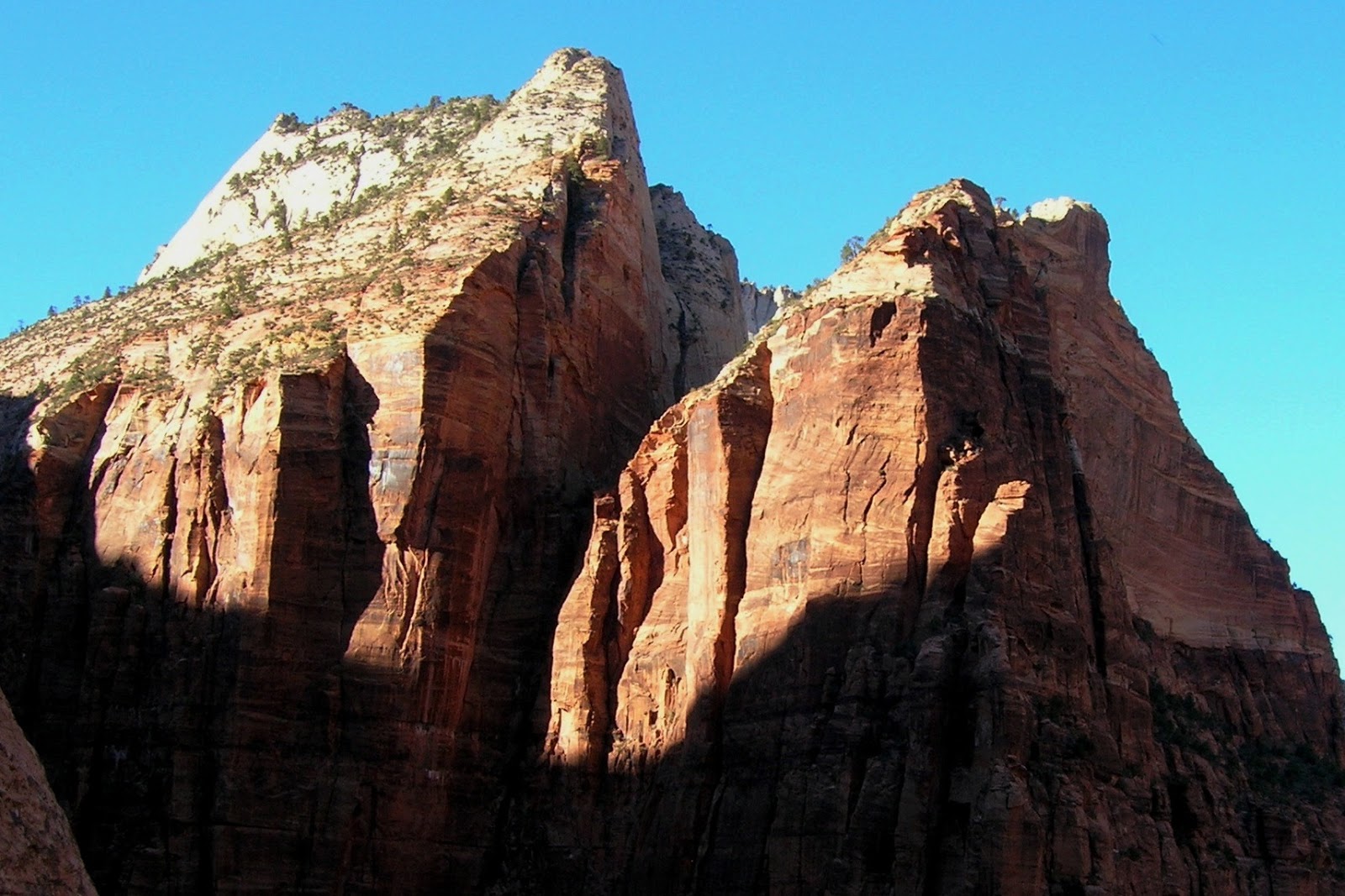
Rick savors the view from what would become our “high point,” over 2,000 feet above the
canyon floor. Comparing our elevation to the opposite side of the canyon, I know we’re close
to the top: just a few hundred feet to go. But Patrick has fallen out, hunkered down on a
ledge several hundred feet below us. And now we've reached our agreed “turn-around"
time. Summit fever seeps in. The mountaineer in me screams “Go for it!” It is within reach,
but I don’t feel comfortable splitting the party up further, especially this late in the day. So I
pull the plug and turn us around, trying not to dwell on the fact that this is the second time
I’ve had to retreat from this climb.   


All the terrain we scaled up today must now be down-climbed. Carefully. There are big drop-offs everywhere.  (photo by Kev)


This is the other technical pitch, called The Chimney (5.4). After lowering my partners, I rappeled down it.  (photo by Kev) 


Close to the bottom now.


Back at the Zion Lodge, we dropped by the restaurant for a post-climb beer. However, they
wouldn’t serve us alcohol unless we were staying to eat dinner. Huh? So we sat out on the
lawn instead and enjoyed this incredible view. Utah has the most sublime scenery—and the
dumbest laws. 


APRIL 22nd –
No alarm clocks this morning, but everyone is up and about before the sun peeks into the canyon. Everyone looks a little stiff from yesterday’s Lady Mountain endeavor. More so, my ego is bruised from yet another failed attempt at bagging that elusive summit. Quite humbling.  

Today’s objective is Antelope Canyon, a sandstone slot that is 125 miles to the southeast near Page, Arizona. Navajo country. Rick will ride with me, while Kevin and Patrick follow in Kev’s car. The adventure continues.


Kevin arranged the tour of Upper Antelope Canyon, an incredible slot canyon located in the Navajo Nation, just outside of Page. Our guide was Irene and she was awesome, a real sweetheart. I took my good Nikon SLR along, and when she saw me struggling on how to set it up for low-light conditions, she said “Here, let me see that.” She then took my camera and changed several settings before handing it back. She had it wired! She even made me show her each photo afterwards to make sure I got it right. And if I got it right, I’d get a pat on the back. Man, talk about pressure.  (photo by Kev)


The slot in Upper Antelope Canyon is 120 feet deep and around 700 feet long. The Navajo call it Tsé bighánílíní, which translates to “The place where water runs through rocks.” For tens of thousands of years, flash floods have roared through here, the silt-laden water scouring the walls into exotic shapes.


An ancient legend holds that the fertility deity, Kokopelli, would sit deep in the chasm to
play his flutes, using the canyon's ethereal acoustics to lure women inside. 


Upper and Lower Antelope are the most photographed slot canyons in the world. Renowned
photographer, Peter Lik, snapped a black and white image in the Upper not long ago, and
last year, it sold for $6.5 million. But alas, our mystic tour was coming to an end and we
thanked Irene graciously for her impeccable guiding. Soon we were back on the road, Kevin,
Rick and Patrick heading back to Zion. As for me, I drove south, aiming for home by way of
Flagstaff.  


APRIL 23rd –
The first thing I do this morning is text “Happy Birthday!”to Allie. She’s 26 years old today. Man. Is that possible?  

The big winds are back, blowing through Flagstaff under sunny skies. I’ve got a 7-hour drive ahead of me to get home. But first, before I hit the road, I plan to sample some of the singletracks here in town. There's a lot of mountain-biking done around here.  


Flagstaff is nestled in a forest at 7,000 feet, and many of the trailheads are right in town. How cool is that?


It’s rock and roll time.


I rode the Walnut Canyon segment of the Flagstaff Loop Trail. No big grades or obstacles,
just a fast-flowing trail through the forest. Loads of fun. It was this very spot where a half
dozen elk hurtled across the trail in front of me. But by the time I slammed on the brakes
and pulled my camera out, they were across the meadow and into the trees. 


Before heading back to the van, I stopped to kick back and savor the moment. It was bright and sunny, not a sound but the wind sighing through the treetops. The last few days have been quite a journey, from riding atop Gooseberry Mesa, to scaling canyon walls in Zion, to exploring the depths of Antelope Canyon, to taking a spin here in Flagstaff. But by far the best part of the trip was time spent with my old amigos, hanging out around the campfire or dinner table and reminiscing old times. Days like that are priceless.


To see all the photos from this trip, click here...
https://www.flickr.com/photos/91696789@N00/albums/72157668392577636