Thursday, October 27, 2016

Grandeur and Grit on the JMT (Pt.4)


“The mountains are calling and I must go.” 
        —John Muir

After sixteen days on the trail, we landed at the Mammoth Mountain Inn with sincere need of a rest day. We hadn’t planned on taking any Zero Days—we were going to hike twenty-one days straight through—but it was clear that we could use one now. So we extended our stay to two nights, giving us 24 hours to relax and nurse sore feet and knees. But during that layover reprieve, we had to make a decision: We could either jump back on the trail… or call it quits. Three-quarters of the journey had now been achieved and both of us were headstrong to see it through to the end. But 55 miles remained to Yosemite Valley—and our feet had to get us there. In this way, everything hinged on what we could recoup from a Zero Day.
~~~~~~~~~~~~


This iconic landmark, named Woolly, greeted us in the morning. It’s a short stroll from the Mammoth Mountain Inn, across the road from the main ski lodge. Today was deemed a rest day, mandatory sandals-only dress code.          


We took the bus downtown, where we stopped at a drug store to replenish a few first aid items. Even more important, we swung by an outdoor sports shop to grab some things that would, very hopefully, resolve my foot problems.  


This is the way to start lunch at Gomez's Tequileria. Ole! We finalized our game strategy here. Yes, we are going for it; jumping back on the trail tomorrow—but with a modified plan.     


AUGUST 2nd—
Enjoyed a relaxing day. We slept in until 7:00, and then had breakfast with a view of Mammoth Mountain out the window. No rushing about. Later we took the bus into town for some shopping. I picked up a pair of lightweight hiking socks at Kittredge Sports, which I’m hoping will solve my “hot feet” troubles. Also, Trail Boss recommended I purchase this stuff called BodyGlide; she says triathlon competitors use it to prevent skin chafing and blisters. At this point, I’ll try anything that might help. We'll be back on the trail tomorrow, resolved to continuing on, but with an altered plan. In their current state, my toes would not survive the humongous descent (over 5,000 feet!) into Yosemite Valley on the final day of the trip—add to that, Trail Boss is concerned about her knee. Therefore, to assure that our three-week trek doesn’t disintegrate into a death march, we’ve decided to stop short at Tuolumne Meadows. This reduces the distance to 32 miles, which seems very doable in the four days remaining. 

There’s a flurry of activity tonight in our room, stripping down our food supply in the bear cans from five days to four. The lighter, the better. And speaking of lighter: I have lost two inches around the waistline and my pants keep falling down. I figure I’m down at least 12 pounds, probably more. Trail Boss has lost some too. This is it: The last segment of the adventure will soon begin.


Day 18: Terry wears her bug headgear to fend off mosquitoes along the Shadow Creek Trail.
We had caught the 7:30 shuttle down to Agnew Meadows and were hiking soon after. This
trail will take us five miles up to rejoin the JMT. 


Shadow Lake beckons as the perfect lunch spot, with sunny rocks sloping down to the water’s edge. I have stopped here many times over the years. It never ceases to enchant.


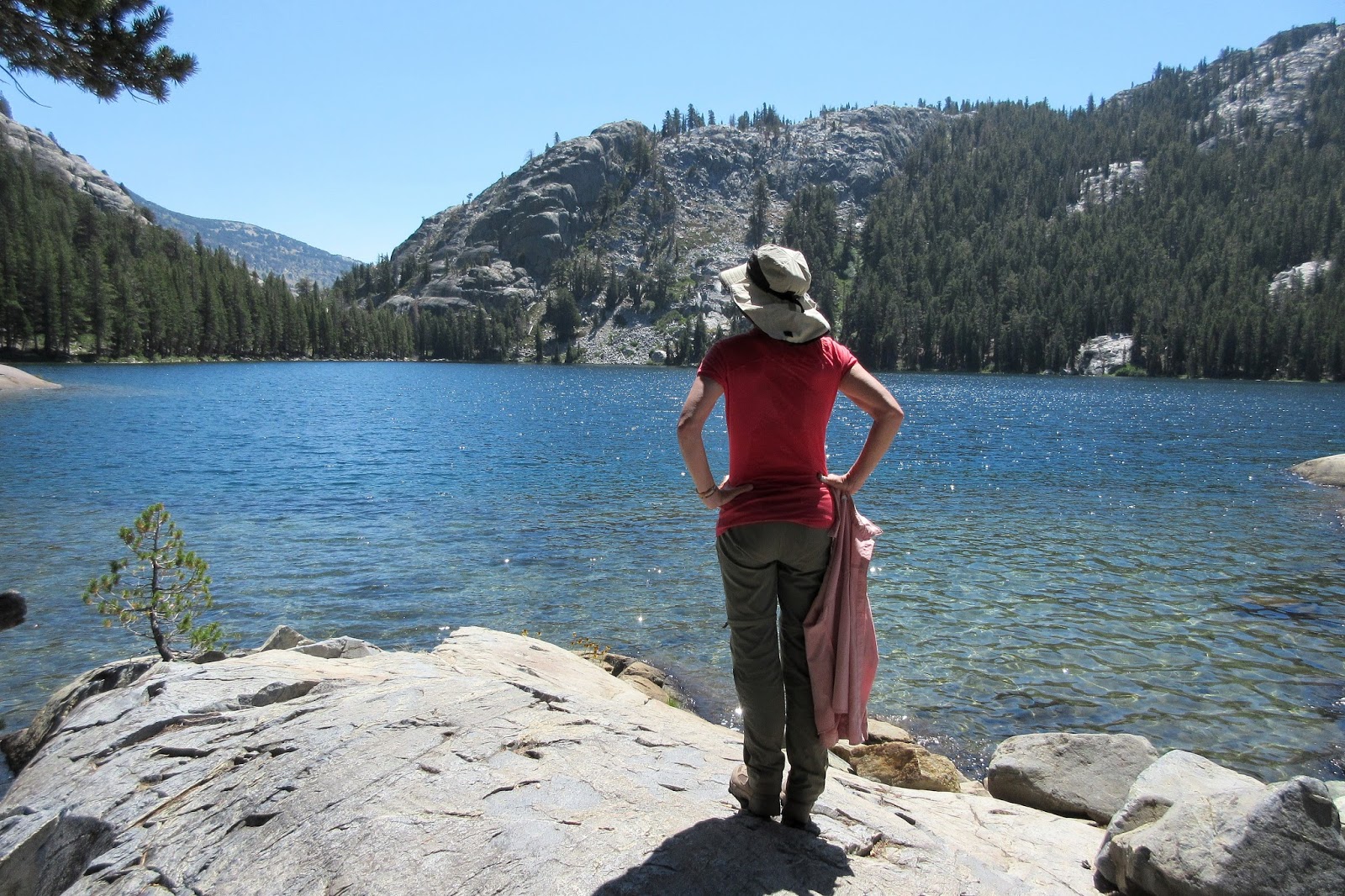
Garnet Lake sparkles in the late-afternoon sun. The backdrop was dazzling and we
immediately started looking for a campsite—which is slim pickin’s here. Soaring above the
lake is the impressive Banner Peak (12,950 ft), and beyond Banner at left is the equally
impressive Mount Ritter (13,100 ft). I’ve climbed both of these peaks (Banner twice): High
Sierra mountaineering at its finest. And as for boldness, the first ascent of Ritter was done
solo by none other than John Muir... in 1872. Dude.    


We eventually found a spot to pitch the tent, a small bench high above the lake. Ter had warned that it didn’t look very level. But I was tired of looking: The few sites on this side of the lake were already taken, and I had no energy or patience for traipsing all the way around to the other side of the lake. As it turned out… my wife was right. Our site was beyond awful. I got stuck with the downhill side of the tent, and all night long, she kept rolling down and sleeping half on top of me. It was one of those miserable nights where you wake up in the morning with little sleep and ask your spouse how they slept, and they reply “Oh, not bad.”     


Sundown on Garnet Lake. Okay, our tent site sucked. But the view of the lake was sublime.


AUGUST 3rd—
We put in 10 miles today andaccording to Trail Bossypants—I'm grumpy. We’re camped at Garnet Lake, which is absolutely gorgeous. Both of us went for a dip. Though my body feels a little weary, the feet did well today. Maybe that BodyGlide stuff is doing the trick? The lighter socks seem to be helping as well. Keeping my fingers crossed.


We got a late start on the morning of Day 19, heading out around eight o’clock. Today’s objective was to cross over Island Pass.  


“Of all the paths you take in life, make sure a few of them are dirt.”  
        —John Muir


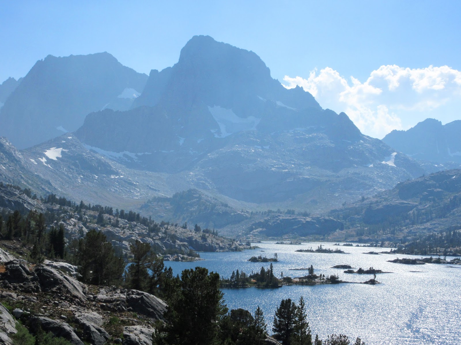
Alpine shooting stars adorn the shore of Thousand Island Lake. We stopped here to pump water and gobble up some badly-needed carbs.


Ter traverses the rolling terrain at Island Pass (10,200 ft). Of all the passes we have crossed,
this one is the lowest and, by far, the most non-descript. We’re not even sure exactly where
we crossed it. Nor do I know how it got the name. Even so, it still made for a picturesque
afternoon hike.  


AUGUST 4th—
Trail Boss is a genius. She really is. The BodyGlide is working better than I ever imagined it could. If I would’ve had this stuff from the start, I could've avoided all these blisters. We logged about seven miles today, crossing Island Pass in the afternoon. Easy day. Lots of cloud build-up, but no thundershowers. Our camp tonight is near Rush Creek at around 10,000 feet. Donohue Pass—the final pass—is two miles further up the valley, which we will tackle in the morning. 

I wonder where Walt & Taylor are tonight? It’s been seven days since we saw them last. And Catherine? Haven’t seen her in eight days. It was sort of cool bumping into them from time to time, sharing the adventure. But since we haven’t run into them for many days now, I doubt we will again.  


Small alpine tarns lace the approach to Donohue Pass on the morning of Day 20. It was an
easy, thousand-foot climb and we blitzed it—demonstrating, once again, that we are strong 

on the ascents. 


Hamming it up on Donohue Pass (11,100 ft) at the boundary marker of Yosemite National Park. The pass was named in 1895 by Lieutenant N.F. McClure of the Army’s 9th Cavalry Regiment. McClure had been tasked with patrolling the new Yosemite NP (the Park Service had yet to be formed), to where he also charted and named prominent features. He named Donohue Pass after a sergeant in his detachment. Also of note: The 9th Regiment was one of the Buffalo Soldier units formed after the Civil War—which means that Sergeant Donohue was most certainly African-American. This would be our twelfth and final pass of the journey. From here it was all downhill to Tuolumne Meadows.


From Donohue Pass, Ter looks down into Lyell Canyon, which is our direction of travel. According to my map, it’s fourteen miles from the pass to the Tuolumne Meadows Grill. To some of these gnarly ultra-light hikers we’ve come across, this would be a piece of cake. But not for us. Our plan is to get fairly close to T-Meadows and find a nice spot to camp. 


The Lyell Fork of the Tuolumne River ambles through the lush meadows of Lyell Canyon. 
The hike along here was exquisite and scenic.  


“I have crossed the Range of Light, surely the brightest and best of all the Lord has built.”      —John Muir


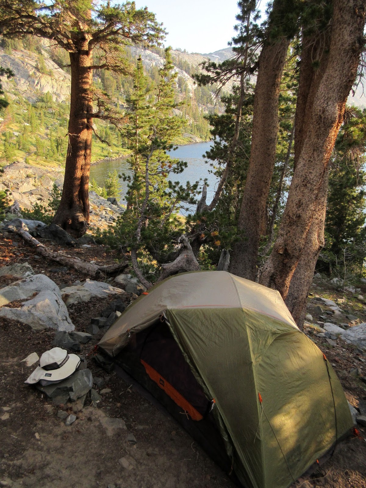
We pitch camp in a secluded spot among boulders, where we set up the kitchen nearby overlooking a vast meadow. It was starting to sink in that this would be our last night in the wilderness. 


Deer graze in the meadow while we eat dinner.  


Last camp on the Lyell Fork.  


AUGUST 5th—
This is the last night on the trail. NPS regulations restrict backpackers from camping any closer than 4 miles from T-Meadows, and that’s about where we are. We’ll be up at zero-dark-thirty in the morning, huffing it to the finish line. As for tonight, we polished off the whiskey. Fun times. Trail Boss even got a tad frisky. But then the sun went down in a hurry and the temperature dropped like a rock and that was the end of that, boy. It’s a New Moon tonight. The Milky Way is amazing; billions of stars; the face of God; the soft murmur of the river flowing by; the croak of a frog. John Muir once explained: "When we try to pick out anything by itself, we find it hitched to everything else in the universe." Yes, everything is connected; you can really sense it out here in the wilderness. But I ramble. Has it really been three weeks since we started this journey? It seems so long ago, yet in a way, just like yesterday. Or the day before. Is it Tuesday? Time holds no measurement here. Without a doubt, this has been an incredible adventure, and I know Trail Boss feels the same way. But tomorrow, when the trek is officially over, my feet will be very happy.  


Day 21: The alarm sounded at four-thirty and we were pounding down the trail by six o’clock. The temperature was well below freezing; frost cloaked the meadow grass; fingers went numb. But we were moving fast and kept warm in that fashion. Our objective was to be at the Tuolumne Meadows Grill when they opened for breakfast at eight o’clock. 


The early-morning sun glints off the Lyell Fork of the Tuolumne River. We must be getting
close to civilization, because we can smell bacon and sausage frying on a griddle 

somewhere. The T-Meadows campground is just up ahead.   


EUREKA! We arrive at the Tuolumne Meadows Grill at 7:45. It’s time for a big honkin’ breakfast. 


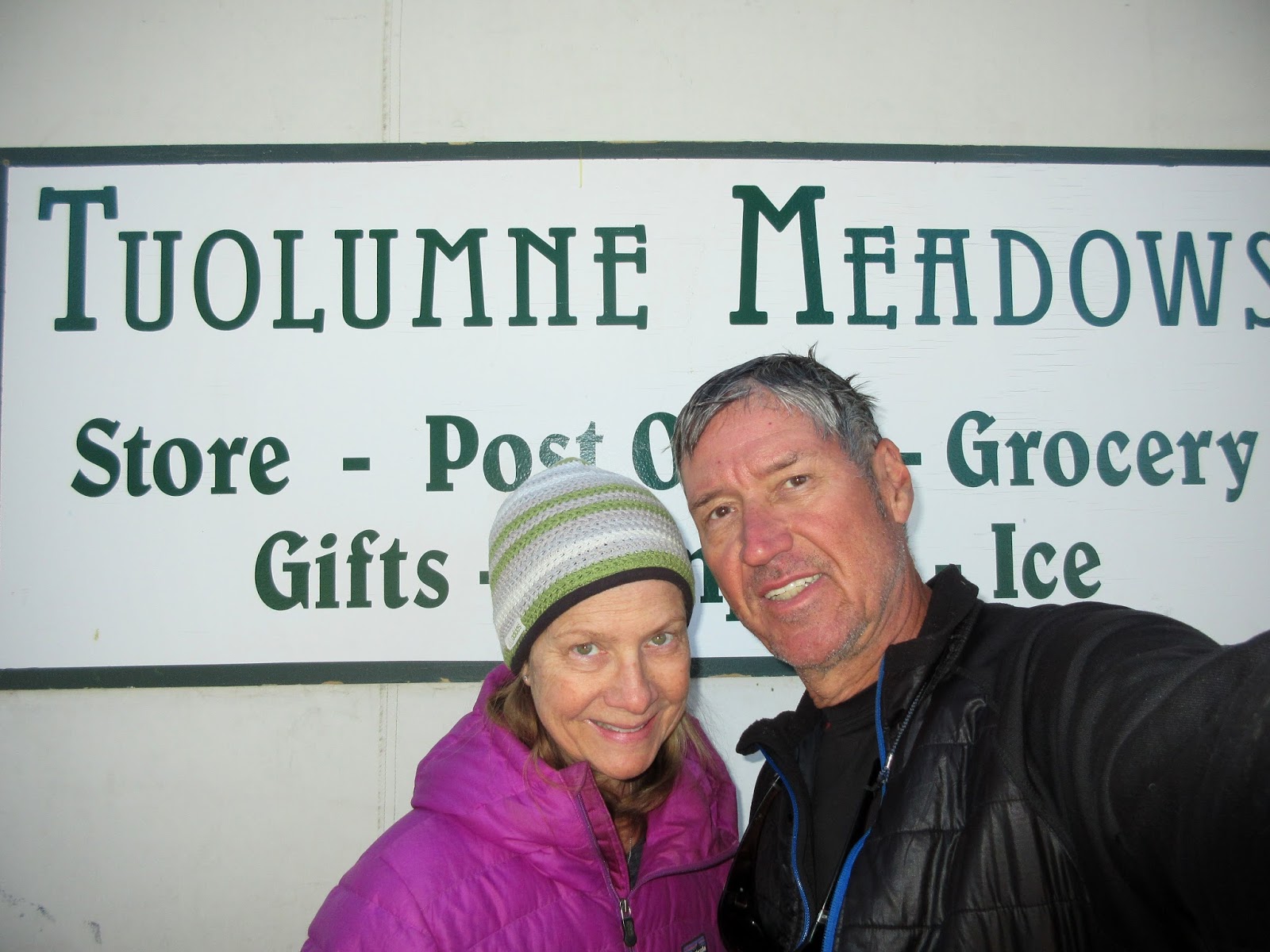
So this is it. The end of the line. We felt no regrets for cutting off the final 23 miles into Yosemite Valley—not sure my toes would’ve survived that big descent. After breakfast, we lounged at the tables in front of the store and chatted with other backpackers who were waiting for the YART bus. It arrived promptly at ten o’clock to take us down to the Valley where our car was parked. And just like that, our epic adventure was over.  
~~~~~~~~~~~~


Interview with a Backpacker
Here’s a rundown of the most Frequently Asked Questions that friends have inquired about since our return. If I’ve missed any, please let me know.  


#1 - How many miles did you hike?
We covered 196 miles in twenty hiking days, for a total elevation gain of 35,800 feet and a loss of 37,300 feet. The toughest section was Day 4 through Day 8 (51 miles), where we crossed over five big passes in five days. Though it was only one-quarter the total distance of the hike, it had a full third of all the elevation gains and losses.


#2 - What was the biggest challenge?
The first big challenge was getting all our ducks in a row before the trip: Securing a wilderness permit six months in advance; planning out the trek’s day-to-day itinerary; coordinating food resupply drops, dates, etc. There’s a lot of moving parts on the front end. The second challenge came during the first half of the trip when we had to make up lost miles over the JMT’s most difficult section (see FAQ #1), otherwise we’d forfeit our reservation at Muir Trail Camp. The thought of losing out on that rustic cabin, fine food and hot shower was too much to bear. We hiked our butts off. 

#3 - Which pass was the most difficult?
For us, I feel the toughest pass was Mather. We started up the last set of steep switchbacks around noon; it was hot; we had already hiked six miles. It was also our fifth big pass in as many days, which probably added to the difficulty factor. From other hikers’ blogs, Glen and Forester are singled out as the monster passes that kick butts. We had no issues climbing either of them—though both had lonnng descents on the other side.

#4 - Any significant problems?
Terry’s right knee was feeling the strain on the big descents in the first half of the trip, especially on Day 8 after tackling the five passes in five days. I battled overheating feet and blisters the first half of the trip, which led to some bruised toes for the second half. My worst day was Day 16, a painful hike into Red’s Meadow. I’ve never had such dreadful foot problems—then again, I’ve never backpacked twenty days in a stretch before. Ter and I had the same boot (Vasque Breeze III), yet by Day 11, I had nine blisters and she had only one. And though my feet were beginning to heal on the second half of the hike—especially after picking up the BodyGlide in Mammoth—three bruised toes would torment me on the steep descents to the very end. Beyond that, we were strong on the climbs to the passes; equipment functioned well; the resupply logistics went down without a hitch. It was all good.

#5 - How much did your pack weigh?
The base weight of my pack was 26 pounds; Terry’s was 19 pounds. Add six days of food and two liters of water apiece, our packs weighed 43 and 32 pounds respectively. Our loads would fluctuate between these numbers, depending on where we were in the resupply cycle and how much water we were carrying at the time.

#6 - Did you bring something that you wouldn’t bring next time?
Terry brought a backpacking shower bag. I think she used it once, but I never did. There was never much leisure time to fill it with water and set it on a sunny rock for a few hours until it was hot.

#7 - What didn’t you bring that you wish you would've brought?
For me, BodyGlide and lightweight hiking socks. If I would've had those things from the start, I would not have had all those blister problems. For Terry, it would be hand cream and lightweight trekking gloves. After a week or more at high altitude, she was plagued with extremely dry hands and cracked fingertips.     

#8 - What was the best thing in your pack?
Whiskey. I brought 750ml of Jameson’s Black Barrel Select Reserve, which weighed two pounds but worth every ounce. It worked out to about 1½ shots per person each evening, making for a nice treat. It lasted nine days. However, our resupply bucket at Muir Trail Ranch included another 750ml for the second half of the trip. Don’t hit the trail without it, we say.

#9 - What did you eat?
Breakfast meals consisted of oatmeal; granola cereal with powered milk; protein bars. We also brought a few freeze-dried eggs & sausage meals, which we wrapped in tortillas and added Del Taco hot sauce packets. Lunches and snacks consisted of various nuts and dried fruit; energy bars; Snickers and M&M Peanuts; peanut butter & jelly on bagels; Tuna and Chicken pouches, to which we added packets of mayonnaise and hot sauce and ate with crackers or tortillas. Dinners were a variety of Mountain House freeze-dried meals. It all worked out to 3.2 pounds of food per day, which was for both of us, or around 6,000 calories per day. This may sound like a lot of calories, but I alone was burning 5,000+ per day on the trail. Except for our gorging at Muir Trail Ranch and Zero Day in Mammoth, we were in a calorie deficit for the entire journey, burning way more fuel than we consumed each day. I lost sixteen pounds by the end of the trip. Terry lost eight. 

#10 - Did you get cold?
Not really. The nighttime temperatures reached freezing maybe three times, and during the day it ranged from pleasant to hot. We didn’t bring a lot of clothing (about four pounds each), so after dinner, if it got too cold, we crawled into our sleeping bags. And we only had one stormy afternoon where we had to don rain gear.

#11 - Did you run into other people?
Ha! The JMT is one of the most coveted trails to hike these days, and due to the high demand and quota restrictions, there’s only a 10-15 percent chance of snagging the preferred southbound permit for July-August—which is why we hiked it northbound, because, for some reason, most people decline to do it in this direction. We probably saw thirty people throughout each day, give or take, the majority traveling southbound. Nevertheless most nights, we could usually find a campsite that was fairly private or outright secluded. There’s a lot of country up there. 

#12 - Is the trail easy to follow without getting lost? 
Umm. If in doubt, ask for directions from one of the many hikers you pass. Or look at your topo map and orientate yourself. We had one incident on the ascent to Muir Pass, where a lady hiking along with us was convinced we were on the wrong trail. I assured her we were on track. Even the fact that I’d hiked this stretch many years ago held no merit with her. She was ready to turn back at Helen Lake when we chanced upon some hikers coming down the trail, who verified that the pass was up around the corner, not far away. I’ve also read blogs that complain of not enough signage at trail forks, and that sometimes people go the wrong way. Again, look at your topo map and orientate yourself once in a while. We felt that the trail signs were there when you needed them. More would be overkill, not to mention take away from the adventure.

#13 - What did you bring in case of an emergency?
Whiskey and a first aid kit. There’s a plethora of emergency communication devices and services out there to choose from, depending on how much $$$ you wish to invest, but we went the old-fashioned route. 

#14 - Did you see any rangers?
Yep. There are backcountry ranger stations along the JMT in Yosemite, Sequoia and Kings Canyon Nat’l Parks, located roughly ten miles apart. A ranger is assigned to each one all season and has satellite radio contact with the outside world in an emergency. We bumped into Ranger Laura Pilewski on Day 1, and her husband, Rob, on Day 2. Wonderful people. Laura was at Rock Creek Ranger Station and Rob was stationed nine miles north at Crabtree Meadows. I asked Rob how they managed to maneuver assignments so close together. He smiled and said “Twenty years of seniority has its perks.” In the winter, they man the Tuolumne Meadows Ranger Station together. One disappointment of the trip was not being able to meet Dario Malengo, who was stationed at McClure Meadows. The guy is a legend: 71 years old and still on patrol. Backcountry rangers have been called “the backbone of the NPS,” and for good reason. They’re the boots on the ground. For a good read, check out The Last Season by Eric Blehm.   

#15 - Did you have problems with bears?
No bear problems, but a near miss. I almost hit one on the drive into Yosemite Valley to drop the car off before starting the hike. It jumped right out in front of us, did not look both ways before crossing the road. There are warning signs at certain places that read “Speed Kills Bears”. At first I thought maybe there was a crystal meth epidemic raging in the bear community. But then a ranger told us that, this year alone, nine of them (as of July) had been killed by cars, and that the signs are located where they cross the road and get hit. So watch your speed, people. As for bears in the backcountry, we saw not one. Nada. Oh, they’re around—we talked to one thru-hiker who saw two—but they seem to be keeping a low profile. Now that the use of bear canisters is required (and strictly enforced), the wily Ursus Americanus has learned that it’s futile to raid backpacker camps for food. 

#16 - What was your favorite section along the trail?
The entire journey was incredibly beautiful. But if I had to choose a favorite part, I would say the Bighorn Plateau and Forester Pass area. I adore the alpine zone for its stark beauty. Terry really liked the Bullfrog/Kearsarge Lakes area, which was very scenic as well. Also stunning were the Rae Lakes; Evolution Basin; the lakes around Banner Peak and Mt. Ritter; the meadows in Lyell Canyon. It’s all very gorgeous. 

#17 - What was the most enjoyable part of the trip?
Skinny-dipping with Trail Boss. And drinking whiskey. Preferably at the same time. :-)

#18 - Knowing what you know now, what would you do differently?
I would plan a Zero Day at Muir Trail Ranch. It’s the halfway point on the JMT and we could’ve used it. I would also consider hiking in the low-top trail runners that half the thru-hikers were using.  


Tuesday, October 18, 2016

Grandeur and Grit on the JMT (Pt.3)


“The clearest way into the Universe is through a forest wilderness.”   
        —John Muir

The six-day segment from Glen Pass to Muir Trail Ranch had entailed long days over four high passes that were inescapably grueling at times. But persevere we did, arriving at MTR—halfway point of our journey—on schedule. On the face of it, the toughest part of the hike was behind us. Now the daily mileages would be a little shorter, the elevations a little lower. And we were certainly leaner and meaner. But the trepidation over Terry’s knee and my feet holding out for another 102 miles was real. Were we taking on too much? It was a valid question. Then again, I didn’t christen my wife "Trail Boss" for nothing, and as for my blistered dogs: I stocked up with enough Moleskin at MTR to march off to war. It was 47 miles to the next resupply at Red’s Meadow, where we also had a room waiting for us at Mammoth Mountain Inn. And we had five days to get there.
~~~~~~~~~~~~


Day 12: We roll out of bed at 6:15, grab our MTR spa towels and saunter down to the hot springs for a soak. The pools are for guests only, each completely enclosed—if there’s nobody inside, lock the gate for privacy and it’s all yours. The water in this one is a steamy 107 degrees. (This is beyond doubt one of the highlights of our stay at Muir Trail Ranch.) Afterwards we donned clean clothes and stepped over to the dining hall for breakfast. Not a terrible way to start the second half of the trip.     


Meals are served in the dining hall, which adjoins the kitchen where Chef Warren works his magic. The Muir Trail Ranch property was homesteaded in 1885 and originally functioned as a sheep ranch (one structure from that era still in use). It was then turned into a guest ranch when sheep and cattle grazing were banished in the Sierra Nevada at the turn of the century. Clark Gable and Carole Lombard vacationed here in 1940, and a regular visitor in the 1970s was film director Sam Peckinpah. There are only about a dozen guest cabins and they’re booked months in advance (reserved ours in February). It’s a slice of paradise, five miles in the backcountry.


These two young ladies are from Austin, Texas, here at Muir Trail Ranch to retrieve their resupply bucket and move on. They are southbound on the JMT; departed Yosemite Valley eleven days ago. The girl on the right had some backpacking/wilderness experience, but her friend had never ever done anything like this before. Baptism by fire on the Muir Trail. 


She smiles tensely as the maelstrom approaches. Ominous thunderheads had been building over Seldon Pass all afternoon while we toiled up the steep grade from MTR. Thunder rumbled, getting closer each time. You could smell it. You could feel it bearing down, and finally we dropped our packs and pulled out the rain gear. We hadn’t been hiking two minutes before the wind kicked up and it started to dump.   


KABOOOOOM! The thunder was deafening, the storm now directly overhead, pelting us with hail. From the fleeting flash-boom interval, I estimated the lightning had struck the ridge a quarter-mile away. We hiked faster. But on the second strike, which was even closer, Ter threw down her pack and poles and took shelter under an overhanging boulder. Come on. Really? She wouldn’t budge. So we hunkered down under the rock until the storm passed.


We set off again once the storm had abated. It was a weird afternoon. Just an hour earlier, 
it had been exceedingly hot, at least 80 degrees in the shade. Now it was in the 40s. 


Taylor and Walt join us for a late dinner at Sallie Keyes Lake. They had arrived and pitched their tent before the storm hit. We weren’t so fortunate. In retrospect, we should’ve got out of MTR earlier. We didn’t leave until noon (I didn’t want to leave at all, actually) and then we faced a hot, steep climb, followed by a wicked thunderstorm that pinned us down. 


JULY 28th—
After eleven dry days, we finally got some inclement weather. It caught us at the top of a relentless 2,300-foot climb, pummeling us with hail, thunder and lightning. We hid under a rock. Trail Boss insisted. The ascent before the storm sucked: The trail was south-facing, mostly in the sun; blistering hot; a real ass-kicker. Trail Boss, on the other hand, cruised it. She left me in the dust. Literally. All of this put me into a foul mood and Trail Boss caught the brunt of itwhich really wasn’t that often since she was usually hiking a quarter-mile ahead of me. In any case she has now, finally, appointed me with a trail name. It's G.O.M. Which, she says, stands for Grouchy Old Man. I told her that's okay. I’ve amended her name to Trail Bossypants.  


Lingering for one last look at Sallie Keyes Lake in the morning before starting up to Selden 
Pass. The lake was named after Sallie Keyes Shipp, daughter of the Shipp family who 
owned the MTR property from the 1890s through 1940. Very scenic here.


We're on Selden Pass (10,900 ft) by mid-morning. It is named after Selden Hooper, a USGS crew leader who surveyed this area in the late 1890s. That’s Marie Lake (named after Hooper's sister) shimmering in the distance, which is where we are heading next. 


Terry wades across Bear Creek, where we stopped after the ford to have lunch and allow our feet to dry. Although thunderclouds were stacking up to the south and west, they never closed in to be a threat. The afternoon was partly cloudy; distant thunder; no rain. Perfect. We pitched camp at the Bear Ridge trail junction, logging 9½ miles for the day.  


Going to the woods is going home.    
        —John Muir


Blue lupines border the trail across Bear Ridge on the morning of Day 14. We had camped 
near here last night: A dry camp with no water source for miles. We had each lugged three 
liters to get us (barely) through yesterday afternoon, last night and this morning. Makes for 
a heavy load, but it would be our only dry campsite of the trip. 


After descending 2,000 feet from Bear Ridge, we cross the footbridge over Mono Creek and head upstream towards Silver Pass. If you turn downstream, a trail will lead you to Lake Edison a mile away, where a boat ferries you across to the Vermillion Valley Resort. Vermillion—or VVR as it’s known to thru-hikers—is a popular resupply station.   


Looking up the North Fork of Mono Creek with Red & White Mountain (12,800 ft) in the far 
distance. We climbed out of the canyon from where this photo was taken. Of the 2,000 feet 
of elevation we lost this morning, all of it had to be gained back in the afternoon. 


We camped below Silver Pass Lake at 10,300 feet, a secluded spot with a small brook nearby. After washing off the trail dust and doing a little laundry, we relax; eat dinner; watch the sunset; hit the sack; fast asleep by nine o’clock. Ours is a simple life. And fully gratifying.


JULY 30th—
It’s a beautiful evening, good spirits prevail. We’re camped about two miles below Silver Pass, which we’ll cross in the morning. Since leaving MTR, we have logged 24 miles and Trail Boss (a.k.a. Bossypants) has made a miraculous comeback. She was fairly beat up by the time we had reached MTR and I was worried about her. But now she’s trucking along without a fuss. This girl has grit. Now it’s me I’m concerned about. The good news: Some of the blisters on my feet are clearing up. The bad news: Three toes are now bruised and hiking downhill is painful. It is now a war of attrition. Bring out the Moleskin. Red’s Meadow is 23 miles away and we have two days to get there.


Early morning, we’re hiking past Silver Pass Lake where people are only now crawling out 
of their tents. It was imperative that we get a jump on the day, as our hiking pace has slowed 
some. We have twelve miles to cover to reach Duck Creek tonight.  


Looking down the north side of Silver Pass (10,800 ft) with Mt. Ritter and Banner Peak lurking on the horizon. Theodore Solomons was the first to document and chart this area in 1892, naming Silver Creek on the south side of the pass, as well as nearby Silver Peak. USGS cartographers took it further when they published the Mount Goddard quadrant map in 1912, giving the Silver name to the pass, lake and divide as well. 


“Another glorious Sierra day in which one seems to be dissolved and absorbed and sent pulsing onward we know not where. Life seems neither long nor short.”         
        —John Muir


We arrive at Purple Lake late in the afternoon. We’ve hiked ten miles so far today and we’re tired—and still have two more miles to go. I misread the map, big time. The terrain was much more rugged than I anticipated: Way more ups and downs. But in the end, we made it to Duck Creek as planned. 


Day 16: This is it! We are packed up by seven o'clock and ready to jump on the trail. It’s eleven miles to Red’s Meadow, and if we can keep up the pace—our backpacks are lighter with no food—we should arrive early afternoon. 


Ter sets the cadence all day long. She’s a trail trooper. Me? That’s a different story. I easily 
kept up with her in the morning, but by noon, had started to fall behind. Way behind. It was 
a long, suffering descent into Red’s Meadow. 


It was truly a sight for sore eyes and feet. And for the first time in over two weeks, we heard the sounds of modern civilization: cars motoring by; a shuttle bus idling; scores of people chattering; dogs barking; babies crying; music. It was audio-sensory overload at first. But in the market was… Ice. Cold. Beer. We took showers and did laundry. We also picked up our resupply bucket. Then we hopped on the shuttle bus that would take us up to Mammoth Mountain.


The feet and the damage done. A week ago, I had nine toes bandaged up. Now I’m down to five. That’s an improvement, right? 


The view from the bar at Mammoth Mountain Inn is superb. After checking into our room, 
we proceeded here and enjoyed a fine meal. Sitting. In a chair. At a table. Wearing flip-flops.  


AUGUST 1st—
We’re at the Mammoth Mountain Inn tonight and I’m still numb. Took a while for it to sink in, but we just got done hiking 164 miles. For sixteen days our mission had been to hike. Every day. Every day hiking in a caloric deficit, burning more fuel than we consumed. I’m tired. Trail Boss is tired. Our bodies—especially the feet—need a break. Layover days were not in the original game plan, but ever since leaving MTR, we had entertained the notion of a Zero Day once we reached Mammoth. And eureka, we have arrived. First thing I did was extend our stay for a second night. 

The next 24 hours will be used to relax and assess battle damage. The final segment to Yosemite Valley is 55 miles. Can we make it? I had a gimp to my stride the last two miles into Red’s Meadow today. I need to get my head wrapped around this, but it’s getting late and my mind is mush. Trail Boss is icing her knee. Tomorrow, she says, we’ll go into town; hit the drug store. She’s got some ideas. Okay. That’s a good sign. One of us is still thinking.  


Continue on to PART 4


Friday, October 14, 2016

Grandeur and Grit on the JMT (Pt.2)


“We are now in the mountains and they are in us, kindling enthusiasm, making every nerve quiver, filling every pore and cell of us.”    
        —John Muir


The first stage of the trek had progressed rather well. We put in thirteen miles the very first day, and though it had us falling bone-weary into our sleeping bags that night—and wondering what the hell we’d gotten ourselves into—we were hiking strong on the climb to Forester Pass three days later. The supply rendezvous with our trail angels at Kearsarge Pass was accomplished without a hitch, so we now had food for the six-day march to Muir Trail Ranch. And it was essential that we reach MTR in six days because we had reservations to stay there on the night of July 27th, which included a bona fide bed in a rustic cabin, a hot shower and three square meals. Clearly we were motivated. But there were 72 miles and four high passes between us and those luxuries. We had our work cut out for us.
~~~~~~~~~~~~


Day 6: Dawn greets me when I crawl out of the tent. We have a set routine now. The alarm
rings at 5:30; we eat breakfast; break camp; hit the trail by 7:30. This morning’s objective is
to cross Glen Pass, which is only a mile away and 600 feet above us.  


Terry beams atop the knife-edge summit of Glen Pass (11,900 ft). Bolton and Lucy Brown, two of the most prolific Sierra mountaineers of the day, discovered it in 1899 and called it Blue Flower Pass after the fragrant sky pilots that blossom among the rocks here. The passage would be a valuable key for turning Theodore Solomons’ dream of a High Sierra trail into reality. For some unexplained reason, the pass was renamed Glen in 1905, named after Glen Crow, a forest ranger assisting a USGS survey team in the area. It just seems wrong to arbitrarily change the name of the pass, but moving on… Off in the far distance are the beautiful Rae Lakes, which is our direction of travel. 


The Rae Lakes gleam like topaz jewels in the afternoon sun. We took lunch along here,
relaxing in the shade of tall pines. These lakes are an angler’s paradise. 


This is the Woods Creek suspension bridge, another engineering marvel on this wilderness
journey. From Glen Pass it was 9½ miles down to here with a 3,500-foot elevation drop. 

We were tuckered out. But there was mileage yet to make up from the Kearsarge Pass 
resupply, so after taking a break to eat supper, we started up Woods Creek and hiked until 
nightfall.  


JULY 22nd—
We covered 12 miles today, not stopping until almost dark. The long descent from Glen Pass was more work than we anticipated. Maybe it’s because our packs are heavy again from the resupply? Plus my feet are giving me problems—it’s like playing Whack-a-Mole: Every time I patch a blister, another one pops up somewhere else. Furthermore I have way over-estimated how quickly we’d be able to hike the big downhill stretches, which is where I thought we’d make up those four miles we’re behind. Even after marching till frickin’ nightfall, we’re still around three miles short. Ugh. 

It’s official. My wife now has a trail name, bequeathed to her by yours truly. I have named her Trail Boss. It makes sense. From the very start, she’s the one who has asserted an aura of proficiency and kept us organized to perfection. She usually picks out the best angle to pitch the tent; has the best technique to fit all the food into the bear canisters; is always the first in the morning to be packed and ready to start hiking. I frequently find myself debating her on an opposing view for a task that needs attention, and in the end, her way is usually right. (As I’m writing this, Trail Boss is looking over my shoulder and interjects that she’s always right.) I don’t have a trail name: My sweetheart has not given me one yet—and you can’t choose your own. When I suggested Renaldo the Magnificent, she rolled her eyes. I know she’ll eventually come up with something. 


Day 7: Today is Ter's birthday. It frequently falls during summer vacation, but this year I wasn’t able to bring her gifts along (the Lamborghini wouldn’t fit in my backpack). I did give her a nice birthday card, though. And Bri gave her this Birthday Girl ribbon in Mammoth, which I had brought along to pin to her backpack today. But there was no sleeping in this morning: We had a six-mile grind up to Pinchot Pass to take on.    


A gaggle of backpackers lounge on Pinchot Pass (12,100 ft). Of the other 14 people here, half of them were British thru-hikers doing the JMT southbound with an American mountain guide. (This is, by far, the most people we saw in one place in the backcountry.) The pass was named after Gifford Pinchot, the first director of the U.S. Forest Service when it was created in 1905. Pinchot was an avid conservationist at the national level, though his philosophy differed from that of John Muir. Muir viewed the wilderness as God’s cathedral where one could venture and commune with Nature, while Pinchot saw it as a commodity that could serve multiple purposes if correctly managed and protected. This difference in viewpoint clashed mightily when the City of San Francisco proposed turning Hetch Hetchy Canyon (inside Yosemite Nat’l Park!) into a giant reservoir. Muir and the Sierra Club vehemently fought it. Pinchot sided with San Francisco. Congress approved it in 1913. 


Lake Marjorie on the north side of Pinchot Pass. As blue as blue can get. 


Terry rambles briskly down one of the easier sections of trail in an attempt to make up time
The faraway valley is the headwaters of the South Fork of the Kings River, which is where 
we're supposed to be camping tonight—if we were on schedule. And we’re not. We’re simply 
not hiking the downhills as quickly as I'd expected. Also of note: Bench Lake Ranger Station 
is near where this photo was taken, where exactly twenty years ago, backcountry ranger, 
Randy Morgenson, set off on a routine patrol and vanished. He was renowned for his 
experience (28 years) anknowledge of the Sierra Nevada's high country. For a good read, 
check out The Last Season by Eric Blehm. 


“Fear not to try the mountain passes. They will kill care, save you from deadly apathy.”       
        —John Muir


Another day, another pass. And today it’s Mather Pass (12,100 ft). The approach took all morning and we ran out of water, obliging us to stop here to pump enough for the final push to the top. The pass (in background) was named in honor of Stephen Mather, the first director of the National Park Service when it was created in 1916 (though the pass wouldn’t take his name until after his death in 1930). Like Forester, Mather Pass was undiscovered when construction began on the JMT.   


The obligatory selfie from the summit of Mather Pass. Yeah, baby! Note the tent pole sticking up in Trail Boss’s pack. I busted it last night while pitching the tent, peeving Trail Boss to no end. Also note our bright, cheery demeanor. This will soon change.


Heading down to the Palisade Lakes on north side of Mather Pass. The peak at right skyline 
is on the Palisades Crest, where four of the Sierra Nevada’s mighty Fourteeners reside (I’ve
climbed three on the Crest: Thunderbolt, North Palisade and Sill).


Terry stands atop the nefarious Golden Staircase—to which she renamed Staircase to Hell 
after descending it. Due to the super-rugged terrain, the 11-mile stretch from Mather Pass 
down to the Middle Fork of the Kings River was the last segment of the JMT to be built 
(completed in 1938). Much of it is steep and rocky, a real butt-kicker. Needless to say, we 
didn’t reach the Middle Fork of the Kings today. At sundown we made camp along Palisade 
Creek, far short of our goal.


JULY 24th—
There’s a pall of gloom over camp tonight. Trail Boss had a meltdown and wants to go home. Extra rations of whiskey were dispensed. Her right knee aches and needs to be iced—but no chance of that happening out here. The Golden Staircase really beat her up, coming at the end of a long day. But the biggest morale killer was the fact that, after all the sweat and blood shed today, we are no closer to getting back on schedule. In fact, I think we lost another mile. And thus we somberly ate our supper in the dark.  

We’ve been on the trail for eight days now. I figure we’ve got another 37 miles left to Muir Trail Ranch, and split over the remaining three days, it seems doable. But Trail Boss is not buying it. Her spirits have hit rock bottom. Even when I tell her there’s a good chance we’ll recover all the lost mileage tomorrow, she’s unfazed. But I’ve studied the map: Tomorrow’s terrain should be easier than anything we’ve done the past few days. Plus it’s mostly uphill hiking, which plays to our strength. If we can reach Starr Camp (11-12 miles), we’re golden; we're back on schedule. But if we don’t... then our chances of reaching MTR on the 27th are slim. I didn’t mention that last part to Trail Boss. But she knows. Like it or not, it comes down to what happens tomorrow. 


We’re happy campers the following morning when we reach Grouse Meadows, where the Middle Fork of the Kings River languidly meanders. At first light, we had roused ourselves out of bed, swiftly broke camp, blitzed the 3½ miles down to the Middle Fork (where I was stung by a bee) and upstream here to Grouse Meadows by ten o'clock. As I had predicted last night, the trail was a piece of cake. But even more significant, all that lay between us and Starr Camp now was seven miles and an elevation gain of 2,000 feet. 


The hike up LeConte Canyon, along the banks of the Middle Fork of the Kings, is truly spectacular. Big granite walls abound. This monolith is called the Citadel, which soars 3,400 feet above the canyon floor. There’s a Dave Nettle route on it called The Edge of Time (14 pitches, 5.10+) that ascends the monster arĂȘte above the snowfield. Sierra backcountry climbing at its finest. Also, to put into perspective the elevation differentials we’re dealing with on a day-to-day basis: Mather Pass—which we crossed over yesterday—is 400 feet higher than the summit of the Citadel.   


We made camp about a quarter-mile above Starr Camp at an elevation of 10,500 feet. FINALLY, after four days of trying, we are back on schedule—and we made it all up in one day. Both of us were elated. To celebrate, we indulged in a sunset revelry and finished off the whiskey. 


“The sun shines not on us but in us. The rivers flow not past, but through us, thrilling, tingling, vibrating every fiber and cell of the substance of our bodies.”      
         —John Muir


Day 10: We wake up to a herd of deer grazing in camp. Curious creatures, they were—and 
no fear of humans. One of them was practically begging for a bite of my egg burrito. 


Terry ascends a snowfield on the approach to Muir Pass. This is the final pass between us and Muir Trail Ranch, and we’re fired up this morning to bag it. 


Two striking alpine lakes sit just below Muir Pass, named after John Muir’s children, Helen 
and Wanda. This is Helen Lake (11,600 ft), which is on the east side of the pass. On the west 
side lays Wanda Lake (11,400 ft).  


We’re on Muir Pass (12,000 ft) at 11:30, striking a pose on the steps of the Muir Hut. The pass was discovered in 1907 by George Davis, who was leading a USGS survey team in the area. In 1930, the Sierra Club constructed the John Muir Memorial Hut on the summit. It is built completely of stone that was gathered from the area, with the mortar, sand and water imported via pack mules. Total cost for labor and material came to $5,810 ($84k today), which was wholly paid for by Sierra Club member George Frederick Schwarz. Thank you, George.


Here’s an interior view of the Muir Hut, looking up at its unique, conical roof. San Francisco architect, Henry Gutterson, designed the structure, borrowing in part from the Agnes Vaille Shelter on Longs Peak in Colorado. 


And we’re just sitting down to eat lunch on the pass, and who comes striding up? Catherine! The last time we saw her was on Kearsarge Pass, where she was hiking out to spend a Zero Day with her parents in Independence. Now she has caught up with us. 


The afternoon was spent trekking down the incredibly awesome Evolution Basin, ambling 
along picturesque alpine lakes. This one is Evolution Lake, looking back the way we have 
come. Mount Solomons—named after Theodore Solomons—is the snow-streaked peak in 
the far distance on the skyline. Muir Pass is the low point on the skyline just left of the peak.


We’re dog tired when we roll into McClure Meadows and pitch camp on Evolution Creek. 
Feet hurt. Knees hurt. But the scenery is truly enthralling, sitting there watching the late-day 
sun play out on the meadows and high country while an angler casts for trout in the creek. 
Then realize that I know that angler. It’s Walt!  We’ve been bumping into him and his 
girlfriend regularly since Forester Pass. 


We stop by Walt and Taylor’s camp after dinner for a short visit. They’re both students at Auburn University; drove all the way out here from Alabama to hike the JMT. They’ve never been to California before. They’re having an awesome time.   


JULY 26th—
We hiked 13 miles today, making camp at McClure Meadows. The ascent to Muir Pass went trouble-free. But the long trudge down to McClure hammered my feet and Trail Boss’s knees. Suffice to say we’re not moving spritely on the steep descents. However, we are now only 12 miles from MTR, and the trail tomorrow should be mostly gradual downhill. It was nice to see Walt & Taylor tonight. Like us, they’ll be heading to MTR tomorrow to pick up their resupply bucket, but not spending the night like we are. I’m looking forward to that soft bed and hot shower.    


The alarm goes off at five o'clock. We skip breakfast and start breaking camp. A doe grazes with her fawn in the meadow. It’s another cold, crisp morning with the promise of sunshine.


Taylor catches a ride across Evolution Creek on Walt’s back. As we stood on the bank and watched him ford the current, proving that chivalry is not dead (at least in the South), I turned to my wife and said “Nope, ain’t gonna happen.” Before crossing, Taylor had explained that she was battling bad blisters on her feet (like me) and had applied fresh Moleskin that morning (like me) and didn’t want to get them wet (like me). Which means my wife should be carrying my sorry butt across the creek. “Nope, ain’t gonna happen,” she said.  


Heavy timber lines the South Fork of the San Joaquin River on the final, seven-mile stretch 
down to Muir Trail Ranch. The trail is mellow. We’re making good time.


We arrived at Muir Trail Ranch mid-afternoon, checked into our cabin and decompressed. Words can’t describe how we felt exactly, but allow me to try: elated; numb; fatigued; grateful; dirty. Once settled in, we washed all our clothes at the outdoor laundry station (a hand-powered washer and wringer) and then took a lonnnng, hot shower. This rustic ranch is completely off the grid. Electricity is generated from an on-site hydro plant. Hot springs provide all the hot water needed. And since the nearest road is five miles away at Florence Lake, everything must be transported in by pack mules. They also straddle the halfway point on the JMT, and thus do quite well in the resupply business: You mail your food bucket to the Florence Lake post office, and they'll haul it up to the ranch on your arrival date. Our bucket had a special prize in it: Another fifth of Jameson’s Black Barrel Reserve.  :-)


We are a table of happy MTR guests who have just finished a scrumptious meal. This wasn’t chuck-wagon grub they served: This was a gourmet feast prepared by an incredible chef named Warren. Most of the two dozen ranch guests ate in the log cabin dining hall, but six of us sat outside under the pines. Sitting across from Ter, left to right, are Chuck and his wife Wendy from Santa Cruz, and Cole from San Diego. Sitting next to Ter is Portland Jim. Good times were had by all, and as the evening progressed, the topic gravitated to the inevitable bear story, because every backpacker has a bear encounter to share—except for Portland Jim, who sat and listened quietly. Chuck, being a retired NPS ranger, had the most and best tales about Ursus Americanus. All of these yarns put Portland Jim on edge, and later that night, after we had all turned in, he was awakened by people shouting and yelling outside his cabin. He was convinced that a bear was invading the compound, so he wedged his trekking poles against the door to barricade it shut and slept with one eye open. In the morning, we learned that the commotion was due to Chinese space junk entering the atmosphere at 17,000 MPH, creating quite a light show. We slept through it. But now Portland Jim has a bear story. Sort of.   


JULY 27th—
Traipsed into MTR at 3 P.M. today, bushed but ecstatic. We’re now halfway through the hike! Trail Boss is in high spirits, especially after taking a hot shower. Washed all our clothes, and then enjoyed a wonderful evening with new friends. The dinner was exquisite. We both dined wearing our rain shells, buck-naked underneath (all our clothes were on the clothesline drying). MTR is a funky, mountain paradise. Our only remorse is wishing we were staying two nights. 

We’ve been hiking for eleven days straight now—117 miles over eight passes. We are definitely feeling the strain; could use a Zero Day here to rest and not have to hike. But it ain’t gonna happen. In five days we have to be in Mammoth or we’ll lose our hotel reservation—though, even if we blew off the reservation, there’s no vacancy at MTR tomorrow anyway. So in the morning, after breakfast, we’ll pack up and say goodbye. But forget about all that. Right now, we’re relaxing in our cabin, feeling the glow of accomplishment. We read in bed. There are no worries, nor are we setting the alarm for the morning. For the first time in a while, we’re not thinking about tomorrow. Let it take care of itself. 


Continue on to PART 3