
“Camp out among the grasses and gentians of glacial meadows, in craggy garden nooks full of nature’s darlings. Climb the mountains and get their good tidings.” —John Muir
Alas, after six months of planning and prep, we departed for the Sierra Nevada to begin the journey: Three weeks on the John Muir Trail. All our ducks were in a row. Resupply buckets had been shipped out; reservations were secured; transportation logistics, all squared away. We were ready—and it had taken a lot of tenacity and sweat to get there. Just a year ago, Terry was immobilized on our couch with a rigid brace on her right leg, ice water circulating 24-7 through a cuff that encircled her knee. She had just gone through ACL reconstruction surgery. A full recovery was going to take at least nine months, and to help keep her mind off the pain and discomfort those first few weeks, we put our heads together to come up with an epic trip for the summer of 2016. There's nothing like a prize out there to get you motivated. And the shiny prize that we put out there was the JMT.
Our first stop was Yosemite Valley, where we parked our car at the dusty, long-term lot at Curry Village (now called Half Dome Village). From there we would take the YART bus to Mammoth Lakes, where we’d rendezvous with daughter-in-law Brianna, who would then ferry us further south and drop us off at the starting-point trailhead at Horseshoe Meadows. After that, all we had to do was hike 220 miles back through the “Range of Light” to the car in Yosemite. No problem. We got this.
~~~~~~~~~~~~
 |
| Bri joins us for our bon voyage dinner in Mammoth. We spent the night at a hotel in town—our last night in a real bed for many days to come—and in the morning, Bri would drive us down to Lone Pine to pick up our permit, and then shuttle us up to the trailhead. |
JULY 16th—
Picked up our permit in Lone Pine this afternoon, after which Bri drove us up to Horseshoe Meadows, dropped us off and headed home. As she drove away, Ter and I looked at each other and I said “Well, Ma, no turnin’ back now.” We shared a walk-in campsite with two other people: a JMT solo hiker, Catherine, and an NPS botanist, Silvia Haultain, who works out of the Sequoia/Kings Canyon NP headquarters where she manages the Sierra Nevada Network Inventory & Monitoring Program. Fascinating lady, Silvia. We learned a great deal about flora and fauna of the High Sierra from her tonight. And starting tomorrow, we’ll get to experience it firsthand.
 |
| Sunrise at Horseshoe Meadows, Day 1. The tent is stowed away and breakfast is done. Since the trailhead is at 10,000 feet, hanging out up here for an afternoon and overnight gave us some time to acclimate. As soon as we finish packing, we’re gone. |
 |
| Terry and Catherine with Horseshoe Meadows in the background. Catherine was solo-hiking the JMT, starting the same day as us. Originally from Philadelphia, though now living in Santa Monica, she’s an effervescent young lady, full of energy and fun to hike with—though after about three miles, it was clear that we couldn’t match her pace. She slowly pulled ahead. Nevertheless, we would bump into her on several occasions over the next 100 miles. |
 |
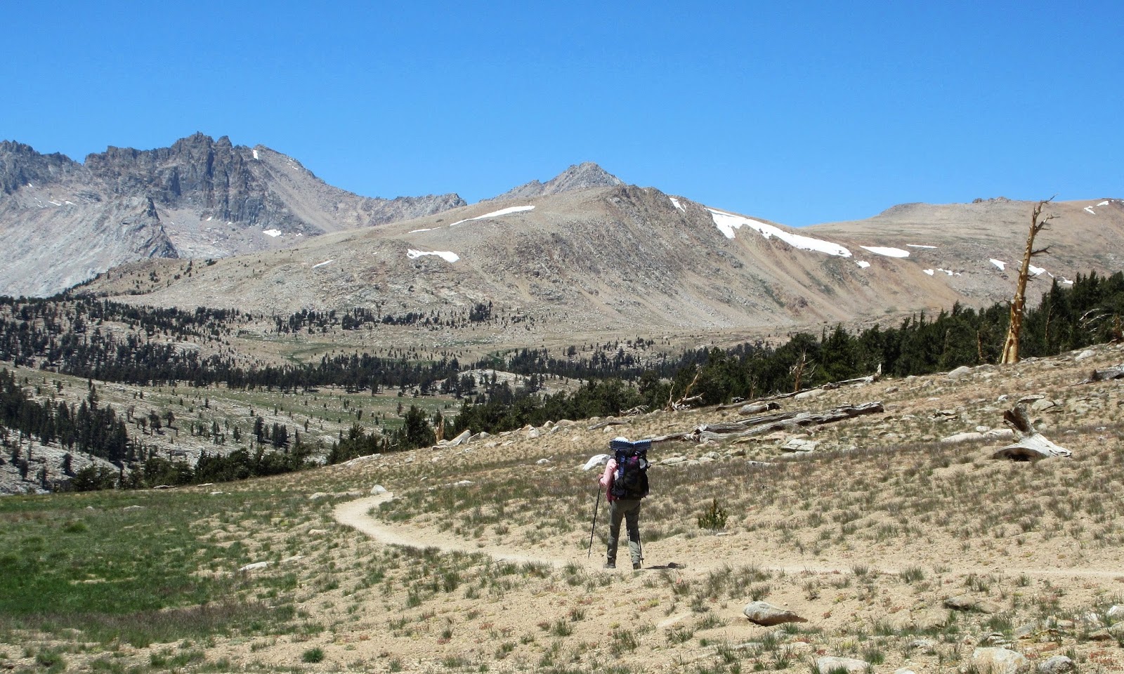
| Ter on the long, hot traverse below Cirque Peak, where the trail was sandy, shade was sparse, and water even sparser. We had made it up to Cottonwood Pass (11,200 ft) by ten o'clock, thinking the hard part was over. Wrong. From there, the trail contoured along at 11,000 feet (photo), for what seemed like forever, before alas descending into the Rock Creek drainage. It was late in the day when we made camp near the meadows at Rock Creek Ranger Station. I figure we covered 12-13 miles on our first day. Both of us were unquestionably pooped and slept hard. |
 |
| On the morning of Day 2, we follow the meadows downstream to where the trail fords Rock Creek and climbs up to Guyot Pass (10,970 ft), the second of thirteen passes we must cross on our three-week journey. |
 |
| Foxtail pine (pinus balfouriana) grace the slopes at Guyot Pass, noble and weathered, clinging to existence in sandy soil where summers are hot and dry and winters bitter cold. Few plants can survive this harsh environment (note lack of undergrowth). Like its close relative, the ancient bristlecone pine, the foxtail can live a long life: The oldest tree verified is 2,100 years old. Which means the forest I’m walking through goes back to the birth of Christ. And the only place in the world where you'll find pinus balfouriana is in the sub-alpine elevations of Sequoia/Kings Canyon NP. |
 |
| A fine view of Mount Kaweah (13,800 ft) from our campsite at Sandy Meadow. |
 |
| My daughter, Heather, had given me 21 sealed envelopes to take along, with instructions to open just one a day. Inside each were a short note and an old family photo that pertained to the subject matter of the note, usually about family travels and adventures over the years. My 8-year-old grandson, Logan, wrote many of them. After setting up camp, the end-of-day routine usually entailed a few swigs of good Irish whiskey while reading these endearing notes. Indeed, it kept the family close at heart on this journey. |
JULY 18th—
Day 2 came to a close at Sandy Meadow. The plan had been to make Wallace Creek today, but we fell 2½ miles short of that goal. Got a very late start (9:30!), but we’ll make it up tomorrow. That said, I’m glad we brought that fifth of Jameson along, because there was cause for celebrating tonight. We joined up with the JMT at Crabtree Meadows late this afternoon, about a mile back. So it’s official: We are now on the... John. Muir. Trail. It’s Yosemite or bust, baby.
~~~~~~~~~~~~
John of the Mountains
and a Trail Through the Range of Light
How John Muir came to land in California was purely circumstantial—it just worked out that way. Born in Dunbar, Scotland in 1838, he was eleven years old when he immigrated to America with his family, where the Muirs started a farm in Wisconsin. He was a bright, inquisitive lad with a love for the outdoors, attending the University of Wisconsin to become either an inventor or a botanist, though he never graduated. It was the scientific explorations of the renowned Alexander von Humboldt that inspired him to leave the Midwest at the age of 29 and set out, on foot, for the exotic jungles of South America. Only he didn’t make it to South America: Florida was as far as he got before contracting malaria and nearly dying. Recovering from that bout, he started to re-think the idea of exploring steamy jungles. It was around this time that a life-long friend, Jeanne Carr, wife of Professor Ezra Carr at the University of Wisconsin, wrote to him in Florida, suggesting he instead go to California where news was spreading about the discovery of a fantastic canyon called “Yosemite.” Thus Muir changed his plans, reckoning that the cooler climes of California would be a better choice for the time being.
 |
| John Muir, 1875 |
Though Muir would later go on to explore and write about other parts of the West and Alaska, the Sierra Nevada—to which he had coined the “Range of Light”—would always be his first love. And as he watched his dear mountains succumb to the depredation of mankind in the name of progress (he referred to sheep as “hoofed locusts”), it had the effect of transforming him into an activist. Something had to be done to protect what remained of this pristine, alpine wilderness. Granted, there were others who were just as alarmed and felt the same way. But Muir had the power of the pen. He had become a prolific writer and his essays on nature were published regularly in national magazines. He had garnered the attention of not only of the general public, but also scientists; poets; congressmen... even a U.S president. Walking in the footsteps of Thoreau and Emerson, he would be the breaking wave of the nation’s conservation movement. In 1890, Congress passed bills designating Yosemite and Sequoia as National Parks. Two years later, Muir co-founded the Sierra Club and served as the organization’s president until his death in 1914.
From the onset, the fledgling Sierra Club organized summer excursions into the Sierra Nevada. Many of the club members were hardy mountaineers, for once you ventured beyond the Yosemite area, trails were scarce and maps unreliable. It was one of those early members, Theodore Solomons, who first nurtured the idea of what we know as the JMT today. He envisioned a continuous, north-south High Sierra trail that would go from Yosemite to the summit of Mt. Whitney. Many of the big passes we know today were still undiscovered, and in the summer of 1892, Solomons led the first of several expeditions into the backcountry, seeking potential routes and documenting the topography. Two other club members, Bolton Brown and Joseph “Little Joe” LeConte, would also contribute valuable topography from their explorations in the 1890s. (The Sierra Club, by far, had the most detailed, reliable maps of the High Sierra by the turn of the century.)
In 1908, LeConte, along with James Hutchinson and Duncan McDuffie, embarked on a cross-country trek from Yosemite to the headwaters of the Kern River, following much of the present-day route of the JMT, proving that a High Sierra trail was possible. However, it would take a few years to convince government agencies to fund such an ambitious project. In 1914, the State of California stepped up to the plate and provided $10,000 to get it started. Construction began the following summer, but it would take 23 years to complete the entire 211 miles from Yosemite Valley to Mt. Whitney. Originally it was to be called the High Sierra Trail. But when John Muir passed away unexpectedly on Christmas Eve, 1914, the name was changed to commemorate him.
~~~~~~~~~~~~
 |
| Truckin' on the JMT. Terry crosses Wright Creek on the morning of Day 3. |
 |
| Lunch break on the Bighorn Plateau (11,500 ft), where the panoramic view is breathtaking. |
 |
| From the Bighorn Plateau, the trail descends into the Tyndall Creek drainage. It was a sweltering afternoon, nary a cloud in the sky or a breeze to cool things off. Upon reaching Tyndall Creek, we soaked our shirts before continuing up towards Forester Pass. |
 |
| We made camp at 12,000 feet, within reach of Forester Pass (the V-notch in the distant rock wall, directly above our tent). |
 |
| Each night, we would review the maps. I had put a lot of thought beforehand into determining where to camp each night for the entire length of the trip, circling each night on the map for a reference point. In this way we could check our progress each day to see if we were ahead or behind schedule. We had three firm dates that had to be kept, so if we were falling behind, the sooner we knew, the better. Our first date was coming up in two more days: We had to meet our friends, Margo and Yvonne, on Kearsarge Pass for a resupply. If we missed them, we would run out of food in a day. Meeting up with them was imperative. And that night below Forester Pass, we were right on schedule. |
“Walk away in any direction and taste the freedom of the mountaineer.”
—John Muir
 |
| We were back on the trail, bright and early, with Forester in our sights. That was our hiking strategy: camp up close to the passes the night before, and then cross them first thing in the morning while it was still cool and no chance of afternoon thunderstorms. |
 |
| The alpine tundra was in full bloom. |
 |
| The final 500-foot headwall to Forester Pass. (Trail marked on photo.) The original route had the JMT veering several miles to the east, off the Sierra Crest, in an end-run around the imposing King-Kern Divide. Construction was well underway in 1929 when a U.S. Forest Service trail crew “discovered” the notch in the King-Kern Divide, and felt that with liberal use of brawn and dynamite, they could make it go, thus eliminating the need to detour miles around. To acknowledge the crew who found this key passage, it was named Forester. Of all the engineering challenges along the JMT, I found this one, completed in 1931, to be the most impressive. |
 |
| Trail construction over Forester was not without risk. A trailside plaque commemorates crewman Don Downs, who was killed when a giant boulder let go during blasting. Three others were injured in the accident and evacuated down to Independence. |
 |
| Looking back south during the ascent to Forester Pass. Our campsite that morning was near the far end of the second lake. The forested canyon beyond is the headwaters of the Kern River. |
 |
| Shazaam! We made Forester Pass by 9:30, no sweat. At 13,200 feet, this would be our highest point of the trip. (We skipped the side trip up to Mt. Whitney since we had both climbed and hiked it many times). |
 |
| Ter begins the descent down the north side of Forester Pass. The rest of the day would be spent hiking eight miles down this glacier-carved valley to Vidette Meadows, losing 3,600 feet of elevation in the process. |
 |
| A Sierra Nevada Yellow-Legged Frog (about 4” long) swims along the bank of an alpine lake where we had lunch. These critters are currently an endangered species, with 95% of their population wiped out. The cause has been blamed on stocking fish in alpine lakes over the years that naturally did not have fish. The fish fed on the yummy tadpoles, and since it takes four years for the little tads to metamorphosize into frogs, it pushed the species to the edge of extinction. The NPS has been actively breeding the tadpoles and introducing them back into the wild, an effort that seems to be working. We saw scores of them in this lake, as well as a few adult frogs swimming around doing the backstroke or the frog kick. |
JULY 20th—
We put in 11 miles today, pitching camp near the Bullfrog Lake trail junction. Forester Pass was awesome; we hammered it. Feeling strong. However, I had to deal with two more blisters that cropped up on the long downhill march from the pass (that’s a total of four now). My feet are overheating in this hot weather; should’ve brought lightweight socks. Full moon again tonight: Last night’s moon below Forester was magnificent. Tomorrow morning we truck up to Kearsarge Pass to meet Margo and Yvonne, who are bringing us six more days of food.
 |
| Day 5: Mt. Brewer basks in the early morning light as we skirt the shores of Bullfrog Lake on our way up to Kearsarge Pass. There we'll meet our trail angels, Margo and Yvonne, who are hiking up from the Onion Valley trailhead. |
 |
| Terry poses with Yvonne atop Kearsarge Pass (11,800 ft). Woohoo! The original plan had called for a pack mule company to bring our resupply down to the JMT trail junction, where we would pick it up and continue north. But when the pack outfitter flaked out at the last minute, Yvonne and Margo volunteered to hike our food up to Kearsarge Pass. This meant we had to divert and climb a pass we had not intended to climb, but on the other hand, these ladies were solving a big dilemma for us. As it turned out, Margo fell ill on the hike up, so Yvonne lugged the entire load the rest of the way, ten miles round trip. And not only did she bring our resupply—which weighed 19 pounds—she also brought us crisp, fresh apples and gourmet olives to munch on. What a sweetheart! That’s why they call them Trail Angels. |
 |
| The Kearsarge Pinnacles as seen from the Kearsarge Pass Trail. It was after noon by the time we bade farewell to Yvonne and hiked back down to the JMT and started the slog up to Glen Pass. |
 |
| We didn’t make it over Glen Pass as planned. Our packs were heavy again; the sun was blazing hot; and then we laid eyes upon this splendid little lake about a mile below the pass and said “screw it” and pitched the tent. We spent the remainder of the day skinny-dipping, doing laundry and sipping whiskey. Ahh, the life of a JMT thru-hiker. |
JULY 21st—
Five days on the trail now and we have covered 46 miles. It’s not a speed record, but we’ve become quite acclimated and have our game down. And we have successfully resupplied. The detour to Kearsarge Pass today has put us about four miles behind schedule. But we have six days to reach Muir Trail Ranch, so I’m certain we can make up the miles. It’s all good. We went swimming in the lake near camp. Very refreshing—although this meant I had to redress all the blisters on my feet. Five blisters now in five days (that’s a new record for me). It was a magical sunset sky tonight, reflecting off the lake. I feel blessed to be able sit and watch it with my dear wife beside me, sharing in the journey. And we're just getting started.
Continue on to PART 2
What an adventure! I can't wait for the next chapter. I felt like I was with you, minus the sweat, pain and blisters. ;)
ReplyDeleteGlad you enjoyed, Kirk. Yeah, more to come.
Deletegorgeous! this is now on my bucket list
ReplyDeleteThanks, Beth. Yep, put it on the bucket list!
DeleteGreat job Ron - really appreciate the narrative to go with the wonderful pics - you really bring it to life!
ReplyDeleteGlad you enjoyed, Kev. Yes, we highly recommend this trip. You would love it!
Delete